You could have written our ride plan on a cocktail napkin and had room left for a pile of beer nuts: explore the back roads of the Nevada-Utah borderlands. We’d passed up dozens of intriguing side roads on previous rides through the eastern fringe of the Basin and Range province; it was time to find out what we’d been missing.
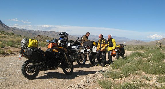
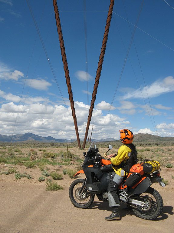
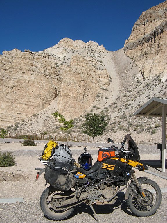
With a nod to preserving our knobbies from the initial slab run to the desert, we lashed our bikes—Kail’s KTM 950 Adventure, Roger’s BMW GS Adventure, and my F800GS—into Kail’s Ford F350 and rode like kings from coastal SoCal to our mid-Mojave rendezvous. Onboard were dinner fixin’s, cold beer and three bikes with fresh Conti TKC 80s. Jim was already there on his BMW R1150GS and had the place primed with chips and salsa for sunset on the deck when we arrived. Not exactly roughing it, but that would come soon enough. And that truck just might come in handy.
Riding over Cima Dome the next morning, we crossed a desert awash in green from recent rains. Despite our empty stomachs (so much for vague plans), the lush beauty held our attention. Every creosote bush, every desert scrub and bristling cholla emitted the radiant light of a plant that has drunk its fill. But beauty only lasts so long, and it ended abruptly when we hit Interstate 15 for the drone through Las Vegas.
Welcome to Nevada…Please Hang On!
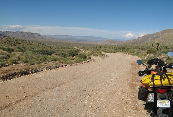
Fifty miles past Sin City, we said, “Adiós freeway, hell-o-o dirt!” at Exit 100 just beyond Glendale, Nevada. Flooding from thunderstorms had nearly severed the freeway near here a few days earlier and Carp Road, our initial dirt experience, showed signs of rain as well. Minor ruts and walnut-sized rocks littered the surface where small washes crossed the road—hardly enough to slow down for, but what was ahead? A map check showed larger drainages waiting for us beyond the low pass in the distance. Four long-time desert dogs knew that could mean an interesting ride.
The rough spots grew rougher as we climbed toward The Summit, becoming something to slow for, then something to slow for and pick our way through. But still nothing to worry about—we’d ridden rougher roads and lived to tell about it. At the top of the pass, an endless expanse of earth and sky greeted our eyes. We stopped to take in the vast, empty landscape sprawling before us, reveling in the wide open spaces.
Then down we went, “into the great unknown,” as John Wesley Powell wrote about sliding into the foaming waters of the Grand Canyon in wooden boats. O.K., it wasn’t that dramatic, but each mile we traveled the road got worse. Descending from Rainbow Pass we started into soft, gravelly sand that sucked at our tires, making the bikes steer like the forks had turned to overcooked spaghetti. At Meadow Valley Road our route had been flooded, obliterating any sign of the road and creating a wide thoroughfare paved with baby head rocks held tight in damp, sandy gravel. Hit them slow or hit them fast, both bike and rider were in for a punishing ride.
But the ditches were something special—sharp-edged mini-ravines popping into view at the last second from behind rocky berms. I thanked my Scotts steering damper more than once for keeping me on the straight and narrow and feared the worst when the forks bottomed with a loud thunk as I hit one of the hidden gullies at an angle. Pitching forward over the Touratech Desierto 3 fairing, I was sure the handlebar would twist to the side and launch me into the rocks. But the Scotts performed as advertised, limiting wheel deflection as the bike and I slammed across together, shaken and stirred…but still a single, upright unit.
Each rider found his own line through miles of rocky wash before the final challenge of the day—a three-foot high revetment thrown up by the flooding wash to keep us prisoner. On the far side lay our salvation, a graded dirt road. It might as well have been in Iowa for all the energy I had left to challenge the berm. Roger took the point, trenching through with his GS Adventure bulldozer, and we all followed through the breach. Charging into to the gap I nearly stalled my 800 in the rubble, but feet found purchase, hands worked throttle and clutch, and adrenaline fueled the assault as we fought the last yards to freedom. My rear Conti gave part of its life in the process, spinning up then grabbing hard and driving us through.
A half-mile later we met the only resident of Carp, Nevada. The old codger was making his way home (a trailer parked up a side canyon) in a beat-up F-150, and assured us that we’d have smooth riding from there on out.
Rainbow Bliss
Soon after our escape from Meadow Valley Wash we were enjoying a heavenly ride on curvy pavement through Rainbow Canyon, named for the multi-colored rock formations that line the roadway. Swooping through turns along a burbling creek studded with cottonwoods and watching the rock colors change as we rode north was a fitting end to a long day. Though there was no pot of gold at the end, finding the rainbow was enough to make the day’s efforts worthwhile.
Much of our route had followed the Union Pacific Railroad, which was unscathed by the floods. We learned later that it had been re-built several times since the original track was laid in the 1870’s, and washed out each time until someone had the bright idea to raise it above flood levels. That necessitated blasting several tunnels, but the tracks are now safe from the ravages of Meadow Valley Wash.
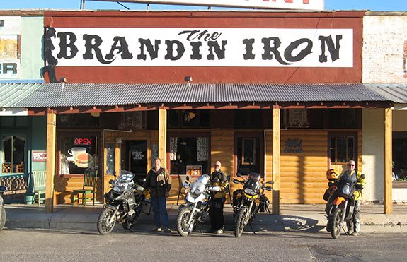
Twenty miles brought us into Caliente, Nevada. Uncoupling ourselves from the bikes, we lumbered into the Brandin Iron restaurant for a well-earned dinner. Sated and tired, we backtracked a few miles to Kershaw-Ryan State Park and pitched tents in the nearly empty campground. Like many Nevada state parks, Kershaw-Ryan has showers, but after a flask of pain reliever made the rounds these tired dirt campers decided that sleep trumped cleanliness. Morning would be soon enough for a shower.
Gray Day
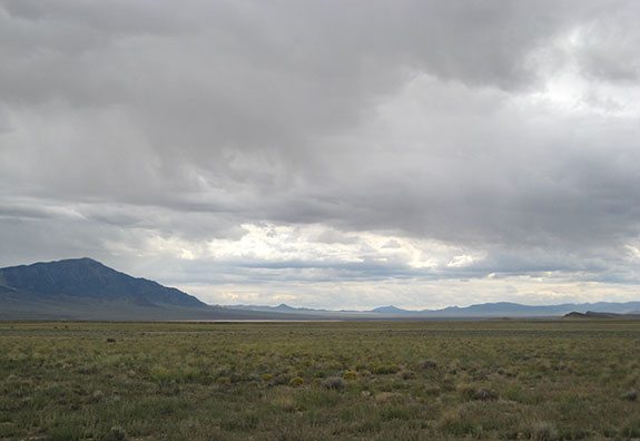
After a sleep so deep that we barely noticed the trains roaring by across the canyon, we were back at the Brandin Iron for breakfast (highly recommended and staffed by wonderful folks) before moving on. Riding beneath leaden skies, we gassed up in Pioche, a mountain-side mining town famous for its million-dollar courthouse (really about $800,000 in 1872). To the west, small breaks in the clouds revealed scraps of blue sky. Eastward the clouds occluded all: not a hint of blue escaped the gray blanket of moisture.
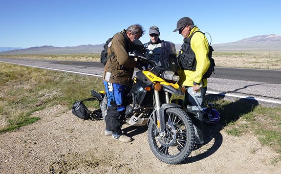
West we went, on smooth gravel across high desert peppered with piñon and juniper. You can read the remains of that day—the tale of my failing stator and how it affected the trip’s events—here. The short version is that I limped into Ely, Nevada, we holed up in a motel until Monday morning, and Shorai batteries are rugged little beasts.
Where is Everyone?
Fortified with a spare battery and a charger in Ely, we re-booted the adventure by heading into parts unknown. We expected a lot of emptiness out there, but the first dirt roads under our wheels led to places where there wasn’t even a cow. Jim surmised it was related to the atmospheric nuclear tests that took place over Nevada in the 1950’s. Those unlucky enough to live east of the test grounds are known as “downwinders” because of the wind-blown blast radiation that fell on their homes, crops and livestock. Many suffered radiation-related health problems. It wasn’t dark enough for us to detect a glow in dirt, but we kept moving in case Jim was right. Too bad, because the area was greening up from recent rain and offered some fine camping.
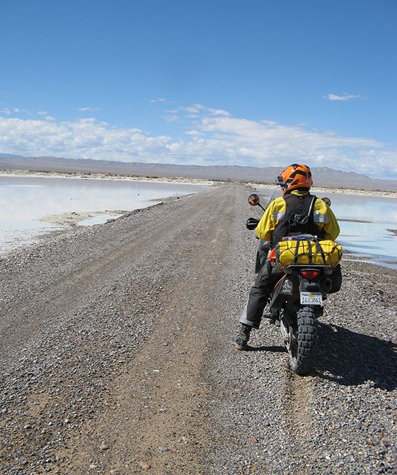
I felt a little better seeing my first cow later that day before skirting the south end of Sevier Lake. Like the Great Salt Lake, Sevier Lake has no outlet and is shown on maps by a dotted line. But this day it was full, its wind-whipped surface reflecting the gray sky overhead, and star-like reflections dancing on the chop when the sun peaked out. Our day ended at the Oak Tree Inn on the edge of Milford, Utah. Performing what would become my standard end-of-day task, I removed the battery from my GS and set it to charging while the boys foraged for cold beverages.
Dig Trilobites?
Penny’s Diner adjacent to the motel filled us to the brim the next morning before we set out northwest on a road covered in red marbles. Traction from the fresh, slippery gravel was hard to find, requiring way too much focus after a big breakfast. More of the annoying red stuff led back to Sevier Lake, where a decent two-track offered better, if rougher, going along the western shore. Crossing U.S. Route 6, we headed into the House Range and Death Canyon. Herein lay the Trilobite Beds, where you can pay to dig your own fossils of these prehistoric arthropods (think spiders, insects, crabs).
A scenic downhill run from Dome Canyon Pass dropped us into Tule Valley, face to face with a wide, wet playa. Roger blasted ahead on the causeway that crossed the briny expanse, the rest of us reasoning that if the heaviest bike made it, we’d be fine. Jetting out of the valley, we turned south on Camp Canyon Road, a blue-ribbon dirt track, possibly our favorite of the trip. This gem was void of vehicles for more than 20 miles, serving up a mix of fast straights and hidden corners, with an occasional mud hole tossed in to keep our attention.
We ate and fueled at the Border Inn, where the food is good and plentiful in spite of the restaurant being the only one for many miles. There were several bikes parked outside and I spoke to a Midwestern woman riding solo on a heavily loaded Star. Setting out to make the trips her late father had planned but never taken, this lady was off to see America and thinking of her dad at every turn in the road.
Camp is Where You Pitch It
Our post-lunch campsite quest along Pleasant Valley Road turned into a full-on expedition—not unusual for this group. Always hoping for the perfect site, we often start too late in the day to find it. With the sun dipping behind the Antelope Range, Jim finally spotted a faint track leading to a secluded spot in the forest. There would be no battery charging tonight, so all fingers and a few toes were crossed that the GS would start the next morning. Meantime, a bottle of liquid campout soothed our aching muscles as we enjoyed the peace and quiet of our remote camp.
Groggy in the cold morning, we slept in before braving fall temperatures at 7,000 feet. Four groans filled the valley as I hit the starter button an hour later and heard just a click in acknowledgement. A jump from the Shorai did the trick, and when I killed the bike later with the kickstand, Jim was there for a bump start.
Heading south from camp, Roger stopped at a two-track side road, and like a wagon train scout pointed in the direction of the converging wheel ruts. The two tracks came and went as we meandered across a pass through the Disappointment Hills and slalomed through a wash down the other side. Popping onto a high plain, we found harder soil and views that extended 50 miles or more.
With a fun run south behind us, we lunched at T&D’s Restaurant in Baker, Nevada, where Terry and Debbie Steadman serve up tasty burritos and burgers. After lunch, Kail used his KTM and a strong leg to push start my GS on a Baker side street. Another battery swap along Utah Route 21 gave my GS enough juice to get to a motel in Beaver, Utah, for the night.
Never Pass Up a Pass
A good sleep recharged our personal energy stores while 110 volts put some zip into my two moto cells. This was a day to bag some passes. A frosty morning’s ride took us over Soldier Pass, cresting the Mineral Mountains between Beaver and Milford at more than 7,400 feet. We traced the edge of the Escalante Desert southwestward before striking west to cross the Wah Wah Mountains on a good road over Red Hill. Taking an extended break at the top we lazed in the sun like reptiles, enjoying the colorful, expansive view westward. The weather had warmed from 48 in Milford to more than 60 here, the skies were clear, and everything pointed to another great day of riding.
A fast run across Pine Valley delivered us to the Indian Peak Range, which we crossed via an unnamed pass. Then it was down to Hamlin Valley with our front wheels pointed towards the White Rock Mountains, just over the border in Nevada. All of us made a full stop to examine an ominous black mud hole in the road as a group of cows gathered around to watch the fun. I’m sure I heard one of them moo his buddy, “This should be good, I just pooped in there.” Kail took it first, sinking deeply but making headway to the far side and a controlled exit. Jim and Roger followed after checking out a second, uglier hole nearby. With the mud thoroughly churned, I dropped in and sank like a stone, stalling the GS. A push of the starter brought the bike to life as the battery gave its all, and out we went.
 |
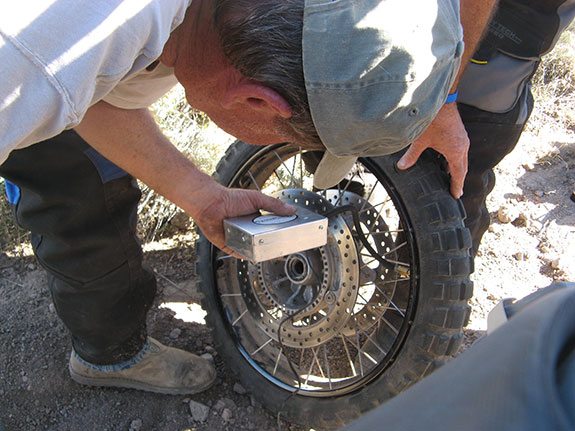 |
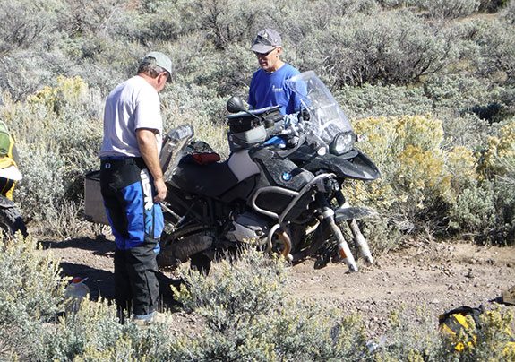
Roger led a spirited ride up the hill on a two-track through pinyon-juniper forest, throwing his GS Adventure around like it was an enduro bike. We finally caught him as he was removing his front wheel to repair a cut in the front tire. Everyone proffered hands, tools and spares.
After patching the inside of the tire, Roger forced my spare 21-inch tube into his 19-inch tubeless tire. Given the compromised tire, it seemed wise to turn back from pass #4 and find smoother going. Hamlin Valley Road was fast going and nearly straight, then Modena Canyon Road entertained us with plenty of wide, smooth pitch-it-sideways turns before we connected to State Route 56 (319 on the Nevada side).
Finale
At day’s end we were back in Caliente, camping at near-empty Kershaw-Ryan State Park, eating at the Brandin Iron…and taking showers before dinner this time. A half-moon lit the cliffs above the campground as we re-lived the trip and mentally prepared for the next day, our last one on the bikes for this trip. That final day is covered in the Shorai battery update here.

 | Ep. 69 Rider Magazine Insider Podcast")


 | Ep. 69 Rider Magazine Insider Podcast")