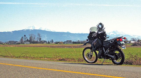
I was riding my Kawasaki KLR650 on a cool, sunny March day. Mount Baker, in northern Washington State, was continuing to be elusive. The inactive volcano in all its snowcapped glory presented a great photo opportunity, but just when I cleared another high ridge, the tree line would appear on the right, blocking my view. I kept the faith, knowing I would get my chance.
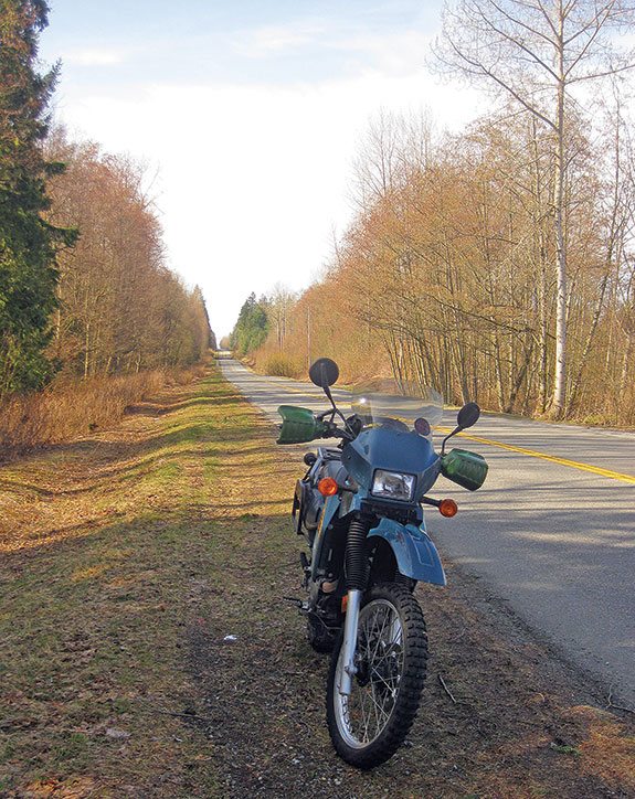
I could see a long, undulating ribbon of asphalt in front of my dual-sport bike’s windscreen, farm properties to the left, thick mossy forest to my right, as I got up on the footpegs to clear another long and low-speed bump. The speed limit was 50 kph and I was in no hurry. The KLR’s potential did seem quite underused, especially on last season’s knobby tires. The trip certainly could not be categorized as a technical ride, and any other place I wouldn’t recommend it, being straight as an arrow and a well-marked secondary road. But it was interesting in another way, because of where I was riding. I was riding in Canada, but 12 feet to my right was the United States of America.
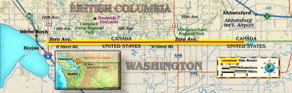
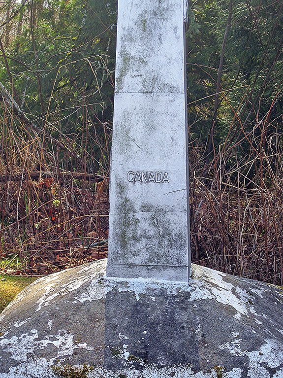
Zero Avenue follows the 49th parallel north quite closely for about 30 kilometers, from Highway 15 in the west until a series of lakes interrupt the road near Abbotsford International Airport. This allowed for a pleasant ride past mainly farmland. As I traveled east, entering the township of Langley, I noticed markers to my right. Short metallic posts buried in a cement foundation stuck out at regular intervals. I pulled the KLR over to the small mossy shoulder to take a picture of one of them. Then, I wondered if I should be doing that.
Having read or been told that there was surveillance equipment and very watchful homeowners along this road, I quickly got my photographs, hopped back on my Kawasaki and continued the adventure. I found a new housing development on the Canada side faced with American swamp on the other and wondered who would choose to live this near to a border, or a swamp.
The noonday sun poked through the treetops and low-lying brush to my right, and the occasional ditch presented the only obstacle to crossing this undefended border. I seemed to be alone on this road and I decided to twist the throttle and accelerate into fourth gear. Not long after I did though, I caught a glimpse of what was unmistakably a U.S. border patrol SUV parked a few meters away on the other side of the border. I instinctively rolled off the throttle. Why was I feeling so nervous?
Just when getting that idyllic photo of Mount Baker was fading from my mind, the road descended, cleared the tree line with a gust of fresh rural air and revealed a vast expanse of green farmland and the peaks of Washington State gleaming in the sun. It took my breath away. Despite my guilty mind, I was going to stop again on the shoulder for pictures.
Straddling the bike, I unzipped my tankbag to take out the camera once again. Then I heard it, the soft crunch of wheels on gravel right behind me. Uh oh. With one eye closed I turned in my helmet to look in my right mirror. It was a small gray sedan. A woman in her 70s exited, also bringing a camera out of her bag.
“Lovely day,” she said to me as she raised her camera to her eye to take a picture of the landscape ahead. I took a deep breath. I’ve got to relax.
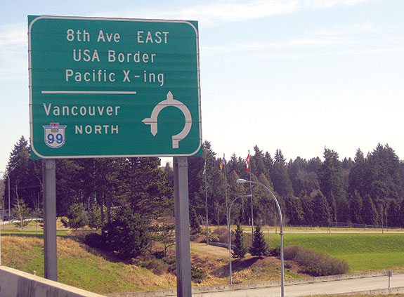
Zero Avenue continued along uninterrupted until the border crossing at Sumas, where the open road was welcome and my motorcycle happily thumped away in the sun.
Looking for differences in how the land is used on opposite sides of the border, I saw that on the U.S. side most of the land was privately owned in massive farm estates and large home properties when it wasn’t impenetrable swamp. On the Canadian side there were smaller farm properties, small regional parks with picnic grounds, campgrounds and winemakers, like Township 7 on 16th Avenue that have branched off from Okanagan Valley wineries.
The first ride of the season had to come to an end. Reluctantly, I turned around to go back to Vancouver, a 45-minute ride away. I pointed my front wheel west for the first time that afternoon, quickly getting the bike back into third gear. I realized that this ride might not have been the most technical, twisty, lengthy or varied choice for a first ride of 2014, but it sure got me thinking about other rides. The possibilities, I thought, on either side of this border are endless.
Suddenly, my previous paranoia was taken over by a sense of freedom and a desire to ride on, whatever side of the border I chose, as I roared off along the open unbending road.
Trevor Marc Hughes is the author of Nearly 40 on the 37: Triumph and Trepidation on the Stewart-Cassiar Highway, a book about his solo travels along remote Highway 37 in northern British Columbia. It’s available through Whitehorse Press (whitehorsegear.com) or his website (trevormarchughes.ca).
 |
 |

 Southern Utah and Arizona Loop | Favorite Ride")


 | Ep. 69 Rider Magazine Insider Podcast")


You seem a little paranoid if you don’t mind me saying so. My kids live in Vancouver, I’ve done the same journey in a hire car when visiting them, unfortunately my Honda was (and still is) back in England at the time. Relax man, I don’t think the Americans are that bad even in these days of international terrorism.
I live in the area Trevor describes and I can tell you the Border Patrol pays very close attention to anyone stopping along this open section of the border. The main concern isn’t “international terrorism”, although nobody here wants that, but drug smuggling. We’re right in the main corridor for drug movements north into the Vancouver area. Barely a week goes by without someone being detained for trying to hump a backpack filled with cocaine across to a courier waiting on the Canadian side. The view from Zero Ave is nice, but it’s not wise to linger long taking photos.