One day I got a postcard from friends who were up on the North Cascades Scenic Highway (Washington Route 20), showing the hairpin turn on Washington Pass. Looked very enticing. The Cascade Range of mountains offers some great riding as it runs the 700 miles from Lassen Volcanic National Park in California all the way to the North Cascades National Park and on into southern British Columbia. These mountains are really a long chain of occasionally active volcanoes. You have to wrap your mind around the fact that this little planet we are on consists merely of a thin covering over a molten core, and sometimes the fire beneath breaks through. Which created Crater Lake National Park, which blew some 7,000 years ago, to the more recent Mount St. Helens National Monument—which erupted a mere 34 years ago. Who knows when the whole range might erupt in synchronization. Time to go there before that happens.
Route 20 being over a thousand miles away, I needed more than a latent desire to take the trip. Then I got press-ganged into being a judge at The Meet, the second annual Vintage Motorcycle Festival at LeMay—America’s Car Museum in Tacoma, so I had reasons enough to head north.
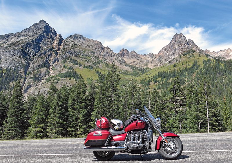
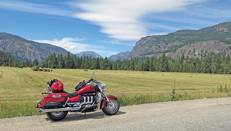
Editor Tuttle, in his inimitable way, offered me a choice of two bikes: the rather small Honda Grom or the very big Triumph Rocket III Touring. I chose the latter, though I had not ridden one since the intro some 10 years back. Figuring this as a 10-day trip, I filled the saddlebags, added a waterproof duffle to the back seat, kissed the wife goodbye and Rocky and I were off.
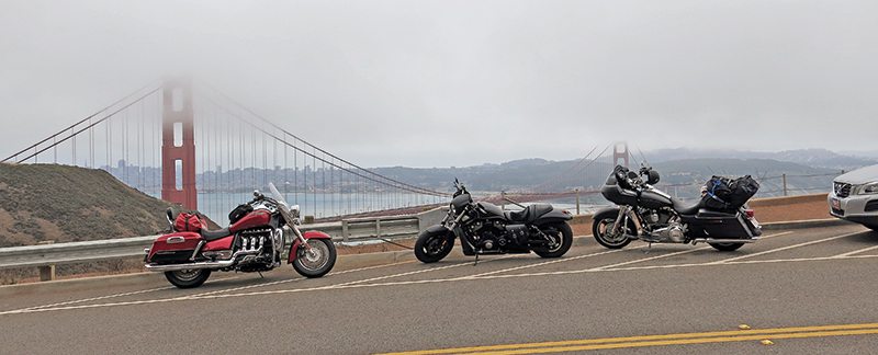
Since the inland valleys were hitting triple digits, I decided to stay close to the coast, crossing the Golden Gate Bridge on a foggy day and spending a night at Garberville in redwood country. The early morning weather was pleasant, and I underdressed for the ride, resulting in the freezing of my butt after dropping into the ocean fog north of Eureka. Of course, I told myself it would warm up pretty soon and did not stop to put on extra layers. By the time I got to Crescent City, 90 miles right along the beaches, I was pretty well frozen. All I wanted was sunshine, so I angled northeast on U.S. Route 199 toward Grants Pass, Oregon, and after less than 10 miles broke out into the sunlight at a wide spot in the road called Hiouchi.
It had one small café that served up good, hot coffee, meat locally made by Taylor’s Sausages, and I imagine the eggs may have well come from a local farm. A 5-star breakfast—maybe the food tasted so good because I was so hungry, but the two-person staff was superb, and the cook kept flipping me different sausages that he thought I should taste. Highly recommended.
Rocky and I headed north to the house of old friends in the northern Willamette Valley, near Albany. The next day, friend Bob and I went off to explore some byways in the local national forest.
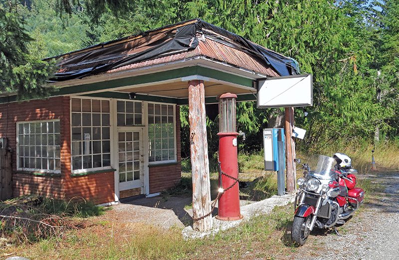
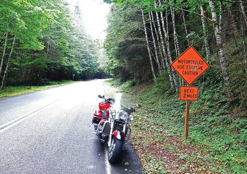
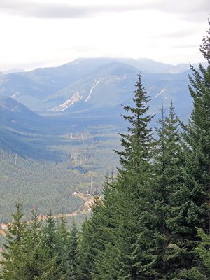
A good two-thirds of the Cascades are part of our national forest system, with miles of nice paved roads, often single-lane and not plowed in the winter. The last time Bob and I had tried Forest Road 11 in the Willamette National Forest, in the late spring some four years back, we had been blocked by snow. This time, in August, it was open. Despite its 900-pound heft, Rocky does well on these small roads, although making U-turns for photo purposes can be a chore. Bob’s Triumph, a Tiger 1050, was a good deal more adept.
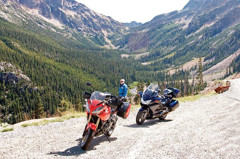
Then I had to head off to do my judging chores, so I wound around cloud-shrouded Mount St. Helens and Mount Rainier to end up in Tacoma, where the Saturday show would take place (see sidebar). On Sunday, some 100 festival riders gathered to make a 75-mile loop around Rainier, but Bob and another old friend, Carl, showed up at the hotel at eight o’clock in the morning to hustle me off on our own ride—which was over that northernmost route to cross the Washington Cascades, Route 20. And what a ride it was!
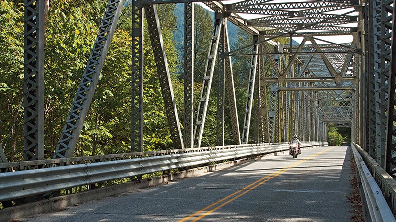
We bored along Interstate 5 for the better part of a hundred miles before turning east on State Route 530, which runs along the Stillaguamish River and then the Sauk River, before meeting up with the Skagit River that parallels Route 20. The west side of the Cascades is all very green, as it gets beaucoup rainfall from the Pacific moisture, with many rivers rushing toward the ocean.
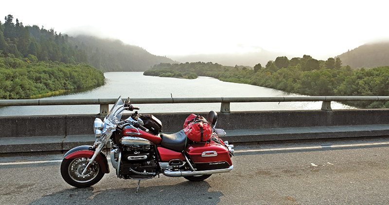
Route 20 actually splits the North Cascades National Park. Three dams on the Skagit River create two small lakes and one large, the 20-mile-long Ross Lake. The smaller lakes are accessible from the highway, but if you want to put a boat into Ross you will have to go up to Canada.
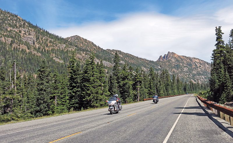
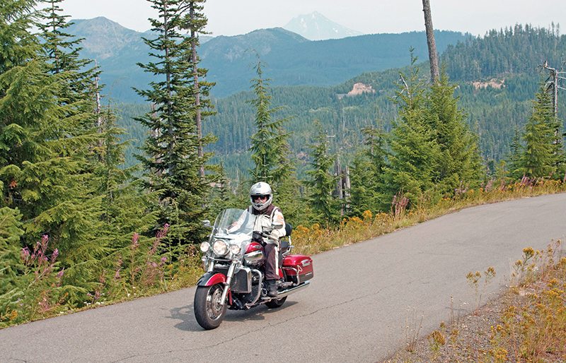
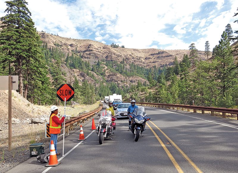
The highway, completed in 1972, is well made and has mostly light traffic, not abused by many 18-wheelers. Almost half the vehicles we saw were motorcycles; sensible folk. The three of us managed to stay well in front of whatever car traffic there was and had an absolutely marvelous run from Marblemount to Winthrop, stopping every few miles for stunning shots of the craggy peaks around us.
The sun was shining brightly as we came over Rainy Pass, but a few days later, heavy rains and landslides did cause the road west of the pass to be closed for a week…one more reason to keep my good-luck charm with me. Then it was on to Washington Pass, at 5,500 feet the highest point on the highway, with great views of the Early Winters Spires, a jagged row of rocky granite peaks favored by climbing types who like to challenge disaster.
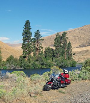
From the pass, the road descends almost 4,000 feet to the tourist town of Winthrop, noted for its board sidewalks and over-zealous police force—it’s rated by the National Motorists Association as one of the worst speed traps in the country. We tiptoed through. Then it was south along the Methow River to meet up with U.S. Route 97 and the Columbia River at Pateros. The Cascades are more or less bracketed by I-5 on the west side, U.S. 97 on the east, the two roads meeting up at Mount Shasta in California.
The east side of the Cascades is very different from the west, as the eastern fields and orchards run into foothills and then rise into mountains. The well-watered land is immensely fertile, with extensive orchards supplying apples, cherries and peaches to a goodly portion of the country…and beyond. Every couple of miles, fruit stands, some big, some small, offered the produce and “free samples.”
We were headed for a proper tourist trap for the night, Leavenworth, a small town which once prospered with railroad and logging work. After the railroad moved its maintenance yards and the forest was pretty much denuded, the city fathers and mothers decided some 50 years ago to turn the place into a sort of Bavarian hodge-podge to attract tourists. The one German restaurant we tried did not get a thumbs-up from us three, all of whom had served in the U.S. military in Germany.
Morning found us heading south on U.S. Route 97, and then at Ellensburg cutting off onto Canyon Road (State Route 821), which follows the Yakima River—25 miles of bliss. Ninety-nine percent of the traffic goes on the new Interstate 82 to the east, so the twisty old byway was all ours…and it is high on my list of must-ride roads. At Yakima we headed west on U.S. Route 12, a trans-Cascade highway going over the 4,500-foot White Pass. Fortunately there was a spot of construction early on, and we eased our way to the head of the long line—which meant we had no traffic problems for the next 40 miles.
At Randle, Carl headed home to Olympia, while Bob and I went south on forest roads. Rocky’s suspension felt darned good, and I never bottomed out while bouncing through all the serious depressions in the pavement. Looking at my riding tactics in his rear-view mirrors, Bob commented, “Surfing down those roads with you in my wake was like being chased by an Exxon supertanker.”
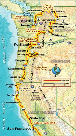
We had originally intended on crossing the Columbia River at Cascade Locks and going down the east side of Mount Hood, but the smoke from forest fires was so thick we gave it a miss, heading along Interstate 84 to Portland and then down I-5 to Bob’s house.
Next morning, reading about the continuing triple-digit temperatures in the inland valleys, I passed on going to Crater Lake and Lassen Volcanic national parks and headed back to the coast instead. To my thinking, it is obvious that the Rocket III was designed in the British Isles, where the temps rarely go over 85 degrees F. I found that at about 90 degrees, the heat from the exhaust side of the cylinders warmed up my right inner thigh more than was comfortable. But that is the only complaint I have with the machine.
Good trip, great roads, even turned a respectable 36 mpg over the 3,000 miles. Only problem is that I need an excuse to go back there and ride some of those roads I did not get to. Before the whole range blows up.
(This article Rocketing Through The Cascades was published in the June 2014 issue of Rider magazine. A sidebar titled The Meet was also included in the issue.)
 |
 |
 |
 |
 |
 |


 | Ep. 69 Rider Magazine Insider Podcast")