Story and photos by Phil Buonpastore
When I wake up in the morning, the first thing I do is look out the window. It’s a habit I’ve acquired since moving to the Seattle area. Given the sometimes long periods of cold and rainy weather from October to April, any clear day warrants an immediate change of plans to include getting on the bike and going for a ride. The shorter days and winter weather at higher altitudes also limit how far into any of the mountains that surround Seattle I am likely to ride, but as spring arrives, clear and comfortable riding days become more frequent. As the day length in the northern hemisphere increases and average temperatures warm, it extends the riding day and the range of travel with each passing week. But until early summer, upper elevations and mountain peaks can still be snowcapped, with road closures and icy pavement the norm, making sea-level rides a better choice. A late April day turned out to be excellent for a ride on a section of the fabled U.S. Highway 101, on the eastern side of the Olympic Peninsula.
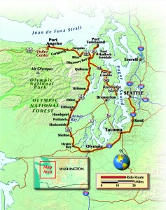
Taking I-5 south to the capital city of Olympia, Washington, then taking exit 105 starts the ride toward the northwest into the peninsula, and in a few minutes I was out of city traffic and onto divided four-lane highway in open country. The highway interchanges are elevated over other connecting roads with expressway-style entrances and exits that keep cross-traffic out of your way, with only a few smaller side roads that occasionally intersect the highway. If you want a quick break from the four-lane ride here, look for the easy scenic detours on “Old” Highway 101 that begin near Oyster Bay at about the 10-mile mark, which offer short diversions that loop back to Highway 101 proper.
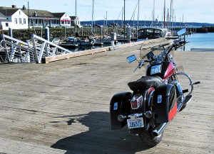
On clear days you can view the Olympic Mountains to the west for much of the ride through this area, and the wide, well-paved highway and open-country ranch-styled surroundings offer a relaxed warm-up ride for the first 17 miles until reaching State Road 3 (another fine riding road in itself) a few miles south of the town of Shelton. From that point, the road becomes more scenic and rural two-lane highway through forested areas and small coastal towns, returning to four-lane only for a small section as the highway approaches Port Angeles at the top of the peninsula.
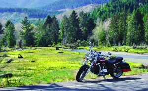
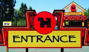
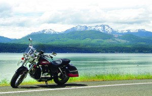
At Skokomish, which is located inside a Native American reservation area, I stopped to take a few photos of the garishly colored Lucky Dog Casino, but not being a gambling man I passed on rolling the dice and rolled on past. A mile or so later the nicest section of the road in this area begins, a designated “scenic highway” for the next 30 miles or so. Here the road runs within sight of the cool and deep sapphire blue color of Annas Bay to starboard, and the emerald green of Olympic National Forest to port. It’s a balm for the soul. Small towns with colorful names like Potlatch and Lilliwaup are located at fairly equal distances along this section of the road, with small restaurants, local hotels and great views should you want to stop for an hour or the night.
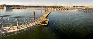
This 30-mile section also has more winding curves than any other section of the road north or south, but nothing extreme, just a good opportunity for some satisfying gear changes and catching a good groove that allows smooth moves through comfortable curves. The personality of the road perfectly matches the personality of the area. Other than some left curves along the coastline that rise into mountains and do not allow you to see through them, if you stay alert and aware, there are generally few surprises or wake-up calls. Just pick the right speed, breathe easy and relax into the beauty of the lean, enjoying the sometimes startling mix of colors and differing topography of the surrounding scenery.
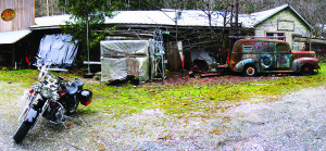
While the length of Highway 101 is only about 120 miles from Olympia to Port Angeles at the top of the peninsula, if you’re a photography buff, be prepared to stop at many locations along the way. It is a beautiful place. Besides the small seaside towns and nautical coastline ambiance, the old roadside storefronts—sometimes with rusting cars and bicycles and the homemade signs of the local seafood and produce stores and stands—make great backdrops for photographs with that rustic “Americana” quality.
Continuing north you come to the Discovery Bay area. If you’re looking for a scenic detour, exit onto Highway 20 northeast for 12 miles to the historic seaside town of Port Townsend. Founded in 1851, Port Townsend has a population of about 9,000 and a rich maritime heritage. Highway 20 becomes Water Street in town, and runs right next to Puget Sound, ending at the Strait of Juan De Fuca. Along the way you pass marinas, historic buildings and storefronts, many different restaurants and a few local hotels. As most of the long-established coastal towns anywhere on the Olympic Peninsula get a fair amount of tourist traffic, local streets and businesses cater to visitors, and the entire town looks like a three-dimensional picture postcard. It’s an easy town to navigate, and one of the more interesting side trips in a riding day on Highway 101. The round trip to town and back to the 101 can be made in little more than an hour, including a stop for a break and some photos.
Before leaving town, be sure to ride to the end of Water Street and detour around the Port of Port Townsend to Hudson Street, where you can park the bike and take in the unrestricted view of Puget Sound and the Strait of Juan De Fuca, Victoria, and other large islands and island towns that surround Port Townsend.
Back on Highway 101, the road heads north for a few more miles before beginning its westward turn at the top of the peninsula, and another 35 miles leads to Port Angeles. If you plan to be back in the Seattle area before day’s end, this is probably the most distant point of the day’s ride. At first Port Angeles seems a bit more conventional and less original in its style, mostly because the town is located on a relatively flat and straight section of Highway 101 that opens up into four-lane divided highway. That conventionality does make it a good location for finding a well-known chain hotel, a gas station or a fast food restaurant, but there are also some hidden jewels for great local rides and very nice lodging choices if you have time to explore a bit or are considering staying overnight. Along the coast of the Strait of Juan De Fuca, great bed and breakfast hotels—some of which are five-star rated—are simply incredible places to stay if you’re looking for a night of luxury accommodations.
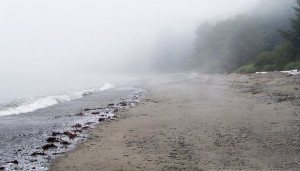
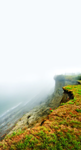
Atmospheric conditions closer to the water can be remarkably different from those just 200 yards farther inland. On an overnight stay with my wife at the Sea Cliff Gardens B&B last summer, the entire hotel and coastline were shrouded in a mystical-looking fog which abruptly appeared like a gray mist curtain just a few streets away from the coast. The edge of the fog was literally that well-defined, and that line between fog and clear skies remained for the entire afternoon after we arrived. Riding a few blocks away from the coast gave way to clear skies and bright sunshine, almost as though we had ridden off a set from the movie Excalibur. Very unusual, and quite amazing.
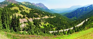
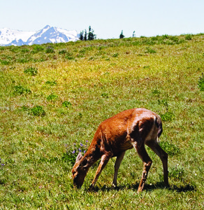
Of course, there’s also the ride on Hurricane Ridge Road to the Visitor Center in Olympic National Park, which is just off the 101 on the southern side of Port Angeles. Besides being a great ride on a motorcycle, riding up to the Visitor Center allows you to view the highest mountains in the Olympic range, including the tallest, Mt. Olympus itself, and to hike a few trails that often allow you to see the Roosevelt elk herds that populate the area.
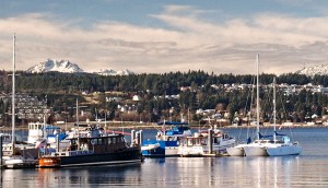
If you live in or are staying in the Seattle area, one of the best features of touring on the eastern side of the Olympic Peninsula is the proximity to the system of ferries that run from many towns bordering Puget Sound back to several locations in Seattle. This gives you the option of timing the length of your ride to a ferry schedule, and to get a more direct route back to the city instead of having to make the return ride to Olympia and around the south side of Puget Sound. If you are intending to return to Seattle at the end of the riding day, it is actually a good idea to incorporate a route to a ferry port as part of the day’s ride, as many of the towns that border Puget Sound offer waterfront roads through some very nice areas, many that have marinas with boats moored at the docks and the slate-gray, snow-peaked Olympic Mountains as a backdrop, offering a spectacular scenic contrast.
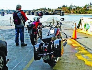
On my ride on the 101, I took the ferry from Bainbridge Island back to Seattle, and the 40-minute ferry travel allowed me to get a bowl of some pretty good clam chowder from the ferry restaurant, enjoy the ride and watch Seattle approach. Once back on terra firma, I rode home in less than 30 minutes.
I have learned several things about motorcycling here during my first year living in Seattle. First, when the weather is good take the opportunity to ride. Second, some of the most amazing scenery offered in the entire United States is just a day’s ride away. Within two hours of Seattle you can be riding on the Olympic Peninsula, in the Cascade Mountains or on Mt. Rainier or Mt. St. Helens, the farthest of which is located less than 120 miles from the city. The catch here, of course, is the weather. From October to April, clear days are somewhat rare—I use them for shorter “maintenance” rides to keep bike and rider in shape. Once into May and beyond, the classic summer weather offers breathtaking visuals from just about anywhere within a 360-degree circle outside the city. While I always keep my rainsuit packed in a saddlebag, the predominantly clear skies, the sunshine and the long days in the Northern Hemisphere in summertime combine to create some of the best riding conditions in the country.

